Mount Raung Volcano Trekking from Banyuwangi
If you are a mountain lover and want to conquer the peak, Mount Raung is an alternative climb when Mount Rinjani *closed*, you don’t have to go far to Lombok, here in Banyuwangi there is a mount Raung one of the highest peaks in Java, compared to Rinjani which is you have to go far to Lombok and spend your time and money its better you do raung volcano trekking
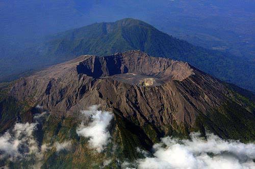
Mount Raung which is the dream of the climbers because of its features (basically every mountain has its own characteristics). The mountain which has a height of 3344 meters above sea level is located in three districts in Besuki, East Java, namely Banyuwangi, Bondowoso, and Jember besides roaring is one of the mountains that has the largest caldera in Indonesia, There are four peak points, namely Puncak Bendera, Puncak 17 , Puncak Tusuk Gigi, and, the highest, Puncak Sejati (3,344 m). This mountain needs several skills from other mountains in Indonesia such as water management, rigging and rock climbing techniques. The Raung climb level is like a level 2 in climb and if it Raung to become the master of the climbers, the level 3 is the peak of the cartenz, called level 1 is like semeru, kerinci, argopuro, Rinjani and others. The unique thing about raung volcano trekking is not necessarily level climb because of the terrain, but the history and heritage that are so interesting when discussed are the reasons why they are called raung, trace palm mountain and some myths such as white tiger and others.
Mount Raung Volcano Trekking from Banyuwangi
Regarding the permission to climb this mountain there are 3 official permits that must be signed by the authorities such as managers, Perhutani, sub-districts and police, in addition if the climb is for the first time it is recommended to use a guide service, for what? Yes, because indeed exploring the mountain is more safety with people who recognize the terrain, situations and conditions.
Raung has 9 climbing camps and on average each camp is 45 minutes to 1 hour except post 1 to post 2 the duration is quite long, it can take up to 2.5 hours. It is recommended that climbers use ojek to post 1 to shorten the time. For maximum water use, a climber carries 7-9 liters for the wasteful category of water (can be calculated for the efficient water) and uses water planting techniques that are usually done at camp 3 or camp 4 to reduce the burden.
The usual time taken is usually only 4 days and 3 nights, including relaxing, besides that, the space is time for maximum rest. The first camp was usually done at camp 3 or camp 4, camp the second night at camp 7
(prepare for summit attack) while the third night is physically dependent, climbers usually stay at camp 7 or go to camp 3. Regarding the summit attack, the ideal time is 3 am from camp 7 with a distance of 2 hours to camp 9 from camp 9 to the flag peak is only 10 minutes.
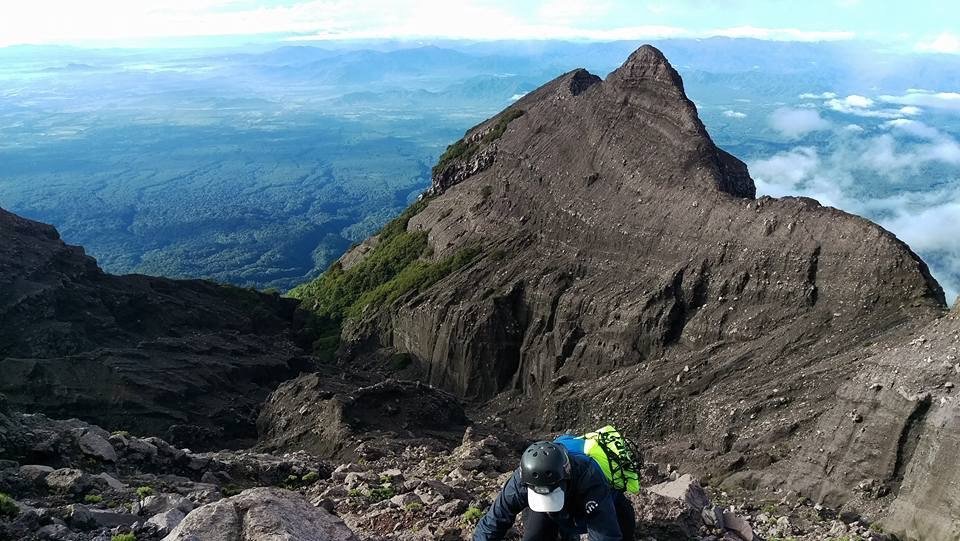
Regarding sunrise usually at the top of the flag the rest depends on the climbers’ mentality. From the top of the flag we will be presented with the splendor of the amazing summit attack mountain raung field. After camp, the 9 vegetation boundaries began to be seen with sand and rock tracks. From the top of the flag, it runs down the edge of the cliff to the bottom at exactly 17 and from there the use of safety is prepared.
Mount Raung Volcano Trekking from Banyuwangi
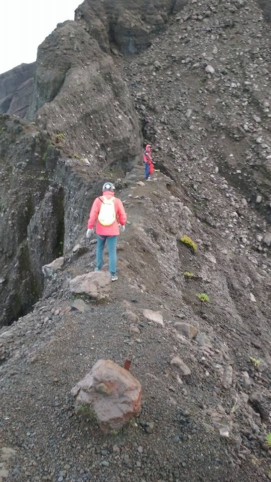
This is where the importance of the use of guide services because the route of the summit attack is not very clear (the terrain of soil and rocks) there are some news such as falling short of understanding the route, it is unfortunate if our lives float because of our own ignorance.
From the summit 17, continue down the hill which is not so high but flanked by two innumerable ravines that surely if we fall, we will die, after going down the summit 17 followed by Shirathal Mustaqim’s journey from that name can be interpreted as the field, the field is still right and left ravines that are countless in depth but beautiful in eyelids.
From Shirathal Mustaqim meet us on a steep descent about 8 meters which must be descended using safety followed by climbing the cliff to the right then the usual derivative and then we arrive at the path towards the top of the toothpick which is so steep in the form of rocks that are very prone to landslides.
The peak of a toothpick can be taken for more than half an hour or so, from the toothpick again we walk up but without safety to the right of the toothpick peak and then arrive at the main peak of Mount Raung namely the (Puncak sejati). From the true peak we will be presented with the beauty of the Raung caldera which is so large with a thin puff of smoke on it
MEETING POINT
Pick up from Banyuwangi area and drive to Glenmore, taking trek preparations and stay for 1 night .
TREKKING
Early morning drive to gate of Mt.Raung and start trekking to camp 7.
AT THE SUMMIT
Camp 7 to summit push start at 2am night, summit Raung Highest point back to camp7 taking launch and after Back to Glenmore thn drive to Banyuwangi /harbour to bali
INCLUDE
- -Profesional guide
- -Porter
- -Sleeping bag
- -Tent/camp
- -Food during the program
- -All Entrance ticket
- -Water during the program
- -Cooking equipment
- -Healthy paper check
- -All Permite licence tO enter the mountain
- -transport from the city the basecamp
EXCLUDE
- -your personal expenses
- -any others thing that is not mention as includE